Master Plan
The Riverfront project creates a public edge along the river on the eastern and western banks. By channeling the river to a constant width of 263m, riverbed land of 204.91 hetares has been reclaimed. The public riverfront extends up to a length of 11.25 kilometers within the city on either banks.
The main considerations in allocating land uses for the reclaimed portions have been: existing land uses along the river; extent, location and configuration of reclaimed land available; potential for development; the structural road network and form of the city; bridges proposed in the Ahmedabad Development Plan; and the possibility of providing adequate infrastructure in the new development.
Land use
The main considerations in allocating land uses for the reclaimed portions have been: existing land uses along the river; extent, location and configuration of reclaimed land available; potential for development; the structural road network and form of the city; bridges proposed in the Ahmedabad Development Plan; and the possibility of providing adequate infrastructure in the new development.


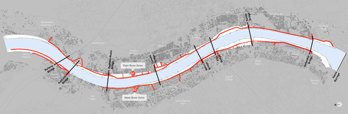
Street network
The project aims at making Ahmedabad’s riverfront a public asset by reclaiming land and improving its overall accessibility. The provision of north-south linkages would strengthen the existing transportation network of the city.
To better access the riverfront and facilities built along it, a number of streets leading up to the river are shall be strengthened and some new streets will be developed. Most of the proposed streets are under construction. The new streets are designed with wide footpaths and designated cycle tracks to improve and encourage pedestrian access to the river.
Recreation
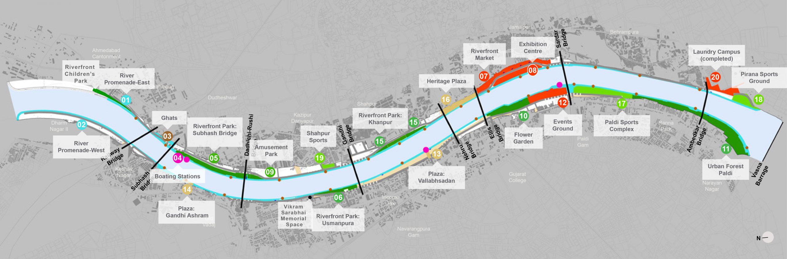
The project aims to create a thriving, people-centric network of parks, waterside promenades, markets, cultural and recreational facilities in the heart of Ahmedabad, making the city’s riverfront a public asset.
The key feature of this project is a two-level, continuous promenade at the water’s edge along each bank of the river. Together, these promenades provide Ahmedabad with a 11.5-km long pedestrian walkway in the heart of the city. Ghats punctuate the lower level promenade at planned intervals to provide access to the water. Boating Stations at the lower level enable water recreation and offer a water-based mode of public transport in the future.
In addition, many new parks, gardens and sports facilities are being built on the reclaimed land. The parks shall enhance livability in the area that they are located in and strengthen the city’s green network.


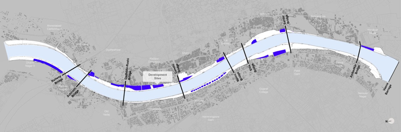
Development sites
The project aims to be self-financing – to achieve its goals without relying on any funding from the government. A small portion of the reclaimed land will be sold for commercial development, to generate sufficient enough resources to pay for developing the riverfront and managing it. The private developments that will be built on the riverfront shall be carefully controlled by volumetric regulations to ensure that the built environment along the riverfront is harmonious and has a memorable skyline.
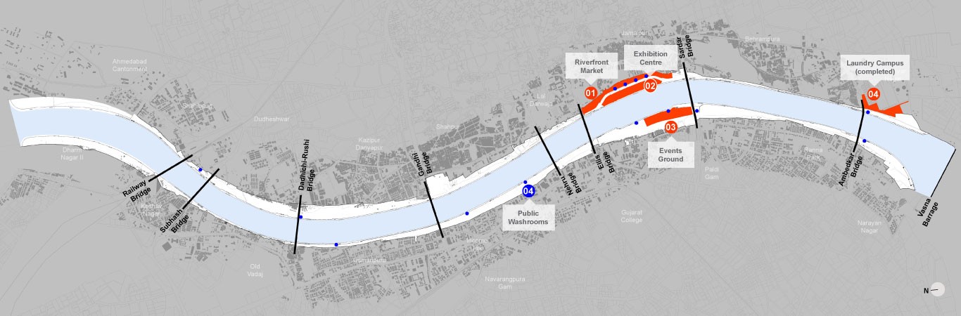
General Facilities
To provide new and improved amenities for the city and to include sections with particular needs, provision of markets and vending areas to include street vendors , laundry facilities for the washing community, trade and fair facilities for the business community have been made in the project. The project replaces a largely private riverfront with an expansive public realm with a network of parks, waterside promenades, markets, cultural institutions, recreational facilities and commercial developments for the city’s five million residents.
